
Last week I blogged about the beginning of a drive my husband and I went on Highway 82 to cross over Independence Pass, which is the highest mountain pass in Colorado. It is only open from the end of May through sometime in October as the rest of the year it is covered with heavy snow. Click here to read that post. That post ended with our stop at the Independence town site--now a "ghost town" of abandoned and crumbling buildings, remnants from a once thriving gold rush site.

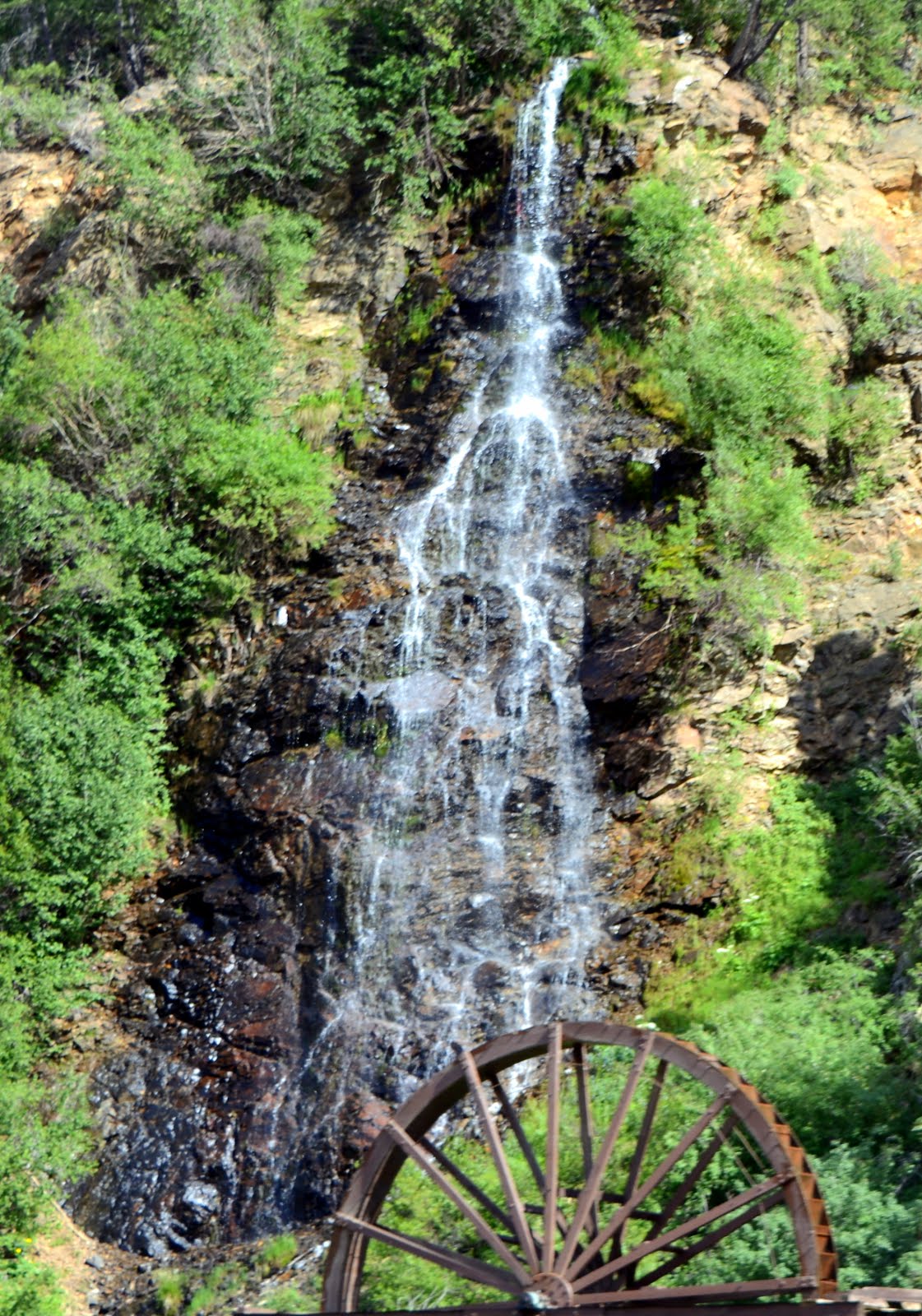
Independence Ghost Town is located 16 miles east of Aspen, Colorado, on Highway 82. There was a parking area off the highway, and then a hike down toward the town. You can see some standing buildings in the photos above as we approached the town.
Legend has it that the town of Independence was formed when prospectors discovered the Independence Gold Lode on July 4, 1879. A tent city sprang up that summer and by the next year there were 300 people living in the camp.

By 1881 the Farwell Mining Company had acquired most of the mines in the area, as well as operated the Farwell Stamp Mill and a large sawmill for their mines. The population of Independence grew to 500 and was served by four grocery stores, four boarding houses, and three saloons. By 1882, the town had over 40 businesses with three post offices and an estimated population of 1,500 people!

Even though we were visiting at the end of the month of May, there were still areas of heavy snow all around the ghost town site. I could only imagine what the winters were like there, with many feet of snow for months on end from October to May, high winds, avalanches, hail, and cold. Those gold prospectors had to be a hardy bunch, desperate to strike it rich, in order to want to live here.


Legend has it that the town of Independence was formed when prospectors discovered the Independence Gold Lode on July 4, 1879. A tent city sprang up that summer and by the next year there were 300 people living in the camp.

Placard on the site--click on it to enlarge.
By 1881 the Farwell Mining Company had acquired most of the mines in the area, as well as operated the Farwell Stamp Mill and a large sawmill for their mines. The population of Independence grew to 500 and was served by four grocery stores, four boarding houses, and three saloons. By 1882, the town had over 40 businesses with three post offices and an estimated population of 1,500 people!

Even though we were visiting at the end of the month of May, there were still areas of heavy snow all around the ghost town site. I could only imagine what the winters were like there, with many feet of snow for months on end from October to May, high winds, avalanches, hail, and cold. Those gold prospectors had to be a hardy bunch, desperate to strike it rich, in order to want to live here.

Placard at the site--click on it to enlarge
Most of the buildings were complete ruins with the exception of a few, yet it was interesting to hike around the site and read the informational placards and imagine life in that era.

This is considered to be the general store, one of the buildings in better condition...

...and this well-built miner's cabin still stands.

Life was harsh here at 10,900 feet and many miners were lured away from Independence to the milder climate of Aspen where they could also find abundant work and good pay.

Although mining at Independence proved to be short-lived, over $190,000 worth of gold was produced between 1881 and 1882. The next year production fell to $2,000, and by 1888 only 100 people remained in the town.

In the winter of 1899, the worst storm in Colorado's history cut off the supply routes to Independence. The miners were running out of food so they dismantled their homes to make skis and escaped to Aspen. It was the end of the town.

To learn more about Independence, and to support its preservation, visit the Aspen Historical Society.

After leaving the Independence Ghost Town we went back on our way on Highway 82 to travel over the pass.

We could see the road gaining elevation ahead...

...and we entered beautiful snowy landscapes as we traveled higher in elevation.

The view looking down at the Roaring Fork Valley was magnificent!

At last, we were at the very top of the pass! There was a parking area and a scenic overlook. The snow at the side of the road was higher than our heads!

We took a photo by the iconic Independence Continental Divide sign...

...and decided to walk to the overlook, as we saw others doing.

Unfortunately, we managed to walk into a snow drift and I began to sink into the snow. At first, I thought it was funny until both legs were stuck in snow up above my knees and I could not move! My husband tried to help me out and then he also sank down into the snow. Two young men thankfully came over and helped us climb out. We were soaked up to our hips and decided that was the end of our walk.

Back in the car, we drove down the rest of Highway 82...

..to its end, in the small scenic community of Twin Lakes. This area has beautiful views of the Sawatch Mountain Range, including the highest Rocky Mountain in Colorado, Mt Elbert, at 14,440 feet (4401 m)

We then drove onto US 24, and into the town of Leadville, at 10,152 feet, it is the highest incorporated town in the United States. In the late 19th century this silver mining town was the second highest in population in Colorado after the city of Denver.

We only had time to drive through, but its historic charm could easily be appreciated and we know we will be back for a longer visit one day soon...

..as we'd also like to ride the scenic Leadville, Colorado, and Southern Railroad train!
From Leadville, we drove back to I 70 East and returned home. It was a very full and exciting day. Colorado has many exciting and interesting places to see, and Independence Pass was definitely worth the trip!
Click here to read part one of our ride over Independence Pass.